A hike such as this 11 day trail has to be planned especially regarding equipment. I planned and hiked all with my dear friend Iris, we travelled also together through New Zealand about which I blogged before. So in this post “we” means the two of us. Our goal was to carry not more than around 15kg including food and water so we had to decide for the most lightweight stuff there is. Hiking together has the advantage of sharing a lot and thus carrying less. Although it was summer, we had sleeping bags suitable for temperatures down to below zero degrees centigrade and we were glad because at high altitude it can be very cold at night. To be as free as possible and not bound to hostels and huts we decided to carry everything necessary to survive for at least 4 days. Our packing list was about as follows: – Rucksack 45+10l – Sleeping bag 0,8kg – Mat 0,8 kg – Tent 1,7 kg – Clothes – Rainwear – Cooking equipment incl. fuel 1,7 kg – Food – Map / route description – Personal items – Water 3 ltr – Hiking poles – Camera
The initial plan was to hike a part of the GR10, thats the trail from the Atlantic Ocean through the French side of the Pyrenees to the Mediterranean Sea. The whole GR10 would take about 35 days and since we had only 11, we had to decide to do only a small part. The train connection to Lourdes seemed the fastest way te get into the mountains. We decided only in the morning of the first day to actually start in Cauterets with a variation of the GR10 through the National Park. On the right is a link to the pictures which I made during the hike. Underneath each description of the day I added a map with the route including hight profile and some other statistics. You may zoom in on the map to see more detail, the numbers represent the kilometers on that day.
Day 1: Cauterets – Refuge des Ouletttes de Gaube
Our hike and adventure started mid august 2012. We had arrived the day before at night so before getting started we had to go shopping and actually get to Cauterets by bus where we arrived during the afternoon. The path went along a popular route with a lot of tourists up to a restaurant. Even though it was very busy it was nice along the river and waterfalls. Initially we thought that camping is only allowed next to a hut so we continued our climb till nightfall. We really arrived exhausted at the Refuge des Oulettes de Gaube. We met a french group of hikers who offered us immediately a cup of wine! They had apparently no abjection to carry it up the mountain and we enjoyed it of course. It is a perfect example of the French hospitality, we had not a single negative experience during our hike! We set up the tent in total darkness with an astonishing sky of stars above. And took a bath in the small river which had its source a few hundred meters above in the glacier. Cooooold! [showhide type=”map1″ more_text=”Show route on map” less_text=”Hide map” hidden=”yes”] [/showhide]
Day 2: Refuge des Oulettes de Gaube – Horquette d’Ossue – Lac d’Ossoue
To wake up in the high mountains is something special. We tried to get started as early as possible to take advantage of the shade for the last piece of ascent. We reached the Horquette d’Ossue around noon, this was also the highest point of our whole trip with 2734m above sealevel. Descending again was quite easy but we needed time to get used to walking for such a long time. We had had enough for that day when we arrived at a small artificial lake. While we set up camp for the night we were witness to a very special phenomenon. While it was silent in the valley with only the sound of sheep here and there, suddenly I heard a swish, it sounded like a distant avalanche. But it was gust of wind blowing down the mountain and over the lake with such force that the water was swept up in the air end waves arose out of the water. I had never seen such a thing before. But it shows how unpredictable the weather can be in the mountains. [showhide type=”map2″ more_text=”Show route on map” less_text=”Hide map” hidden=”yes”] [/showhide]
Day 3: Lac d’Ossoue – Gavarnie – Refuge des Espugettes
The GR10 continued along the valley relatively level and then down to the small village Gavarnie. We allowed ourselves a good meal in a restaurant and reviewed our plans for the coming days. During the whole trip we decided on a day to day basis where to go. We decided to cross the border into Spain which was an ambitious plan. In order to have a head start the next day we continued up to Refuge de Espugettes. The friendly guardian of the hut allowed us to use the facilities all for free, again a example of French hospitality. [showhide type=”map3″ more_text=”Show route on map” less_text=”Hide map” hidden=”yes”] [/showhide]
Day 4: Refuge des Espugettes – Horquette d’Alans – Refuge de Tuquerouye – Valle de Pineta
While we prepared to get started another group of hikers was getting ready as well. I had a short chat with one of them and he offered us to join them up to the French-Spanish border. He told me to expect very difficult terrain so we stayed close to the group. Later when we had to climb up to the mountain ridge at the border we were glad to have some assistance of this experienced group. It was especially difficult to find the path, it was only marked with stone piles which disappeared from time to time into the low hanging clouds. The ascent was incredibly steep, I had never seen such difficult terrain before! It was just a slope of gravel with barely any grip and lose stones everywhere. One would never imagine a path leading up such a place. And suddenly we reached the top and the unmanned hut, a perfect place for lunch. Again with wine from the friendly French group! We entered Spain, a totally different landscape, like on another planet. We crossed a plain along a lake with a glacier on the side and reached the side of the plateau with a astonishing view into the Valle de Pineta. We started a seemingly never ending descent down to a campsite in the valley. It turned out that the campsite did not exist anymore but all we needed was a river to take a bath so we decided to stay anyway. It was the most challenging day but at the same time probably the best day of hiking. [showhide type=”map4″ more_text=”Show route on map” less_text=”Hide map” hidden=”yes”] [/showhide]
Day 5: Valle de Pineta – Bielsa
Next day my foot was inflamed due to the burdening of the day before. We changed the plan and instead of following the GR11 up again, we decided to follow the valley to Bielsa. It was an easy but quite long walk along the river to the small town. From time to time the water was gone in the river and it was completely dry, strange, we couldn’t explain to ourselves why. We saw a lot of wildlife there, butterflies, blue flying crickets, all sorts of birds and even an ermine up close. And we took it easy, my foot was not in the mood of doing too much that day. In Bielsa we needed to take rest and I treated my inflammation at the local farmacie. We enjoyed the cute little town, did some shopping for the next few days and stayed in a hotel where we could freshen up and also wash our clothes which was very necessary as we carried only a minimal amount. [showhide type=”map5″ more_text=”Show route on map” less_text=”Hide map” hidden=”yes”] [/showhide]
Day 6: Bielsa – Parzan – Lago de Urdiceto
With a well rested body and mind we started, first up along the Valle de Bielsa and along an old water shaft to the town Prazan. The route was not very well marked so we had some trouble and funny conversations with the locals. The language barrier posed a problem and the locals couldn’t imagine us being crazy enough to walk back to France instead of taking the bus just like normal people do… Anyway, we found the route which was just a gravel road all the way up the artificial lake Urdiceto. We found a refuge, which was perfect to stay for the night. That night there was a thunderstorm and I was very happy to have a real roof above my head. [showhide type=”map6″ more_text=”Show route on map” less_text=”Hide map” hidden=”yes”] [/showhide]
Day 7: Lago de Urdiceto – Puerto de Urdiceto / Port d’ Ourdissetou – Fredencon (Val de Rioumajou)
We were close to the border so after an hour walk we walked back into France. It was at first very quiet on the path but as we closed in on a road the number of people we met increased. The decent into the Valley of Riomajou was not very spectacular and it turned out that camping was only allowed within the whole valley on two small fields so we were forced to stop early that day. As it turned out it was not so bad to stay because the weather turned and a hale storm made temperatures drop a few degrees. We took shelter beneath a bridge but the cold forced us to retreat into the warm sleeping bags in the tent. [showhide type=”map7″ more_text=”Show route on map” less_text=”Hide map” hidden=”yes”] [/showhide]
Day 8: Fredencon – St. Lary-Soulans
After a wet night we tried to dry the tent on the road. It took long so we started only around noon. Meanwhile we were on the GR105 but it was so bad marked that we lost the official path twice. We ended up along the very steep and rocky side of the valley high up above the road. It was probably much more interesting up there and we enjoyed it. Until, again: rain. Fortunately we were close to St.Lary-Soulans and we found a campsite which suited us just fine. [showhide type=”map8″ more_text=”Show route on map” less_text=”Hide map” hidden=”yes”] [/showhide]
Day 9: St.Lary-Soulans – Estensan – Col d’Azet – Loudenvielle – Germ
Finally back on the GR10 we basically did what was planned in our guide book. That day it rained non-stop and the track was very unspectacular through small villages and fields, a bit up and a bit down but constantly in the rain. Although we could have slept in the tent that night in Germ next to the hut, we decided to sleep in a real and dry bed. Hoping for better wether the next day. [showhide type=”map9″ more_text=”Show route on map” less_text=”Hide map” hidden=”yes”] [/showhide]
Day 10: Germ – Couret d’Esquierry – Les Granges d’Astau – Lac d’Espingo
A look outside made me happy already: blue sky! We enjoyed our breakfast and started for a long day. We had to walk up again to 2131m and entered the Valley d’Ôô down through beautiful beech tree woods and then up again to the impressive crater like lake Lac d’Ôô. The plan was to camp there at the lake but it turned out to be impossible terrain to set up a tent. A friendly French guide advised us to continue up to the next lake where there was indeed a perfect spot next to a river between horses and sheep. Temperatures had dropped fast since sunset and it was really cold even with all our clothes on. Nevertheless I took a quick bath in the river and enjoyed my warm sleeping bag even more afterwards. That night the thermometer dropped below zero so our equipment was tested to the limits. But we did really well and had a good night sleep. [showhide type=”map10″ more_text=”Show route on map” less_text=”Hide map” hidden=”yes”] [/showhide]
Day 11: Lac d’Espingo – Superbagnères
Even though we had decided to start late next day I was up early. It was still freezing cold but a good opportunity to shoot some pictures at the mirror like lake. When the sun was finally up we headed back to the official GR10 track. We knew that we had just a short stretch ahead of us so we enjoyed the last day with good views down the valleys we crossed. The goal for the day was to reach the funicular but we had run out of cash. It meant that we had to walk at least two hours down the mountain. But we were lucky that day, the friendly French ticket salesman invited us to go down for free. So the funicular was the end of our 11 day hike through te French and Spanish Pyrenees. We had a great time together on this amazing experience which I only can recommend to anyone. [showhide type=”map11″ more_text=”Show route on map” less_text=”Hide map” hidden=”yes”] [/showhide]

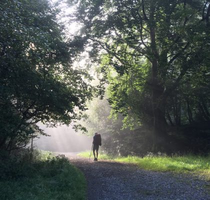
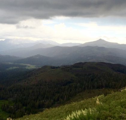
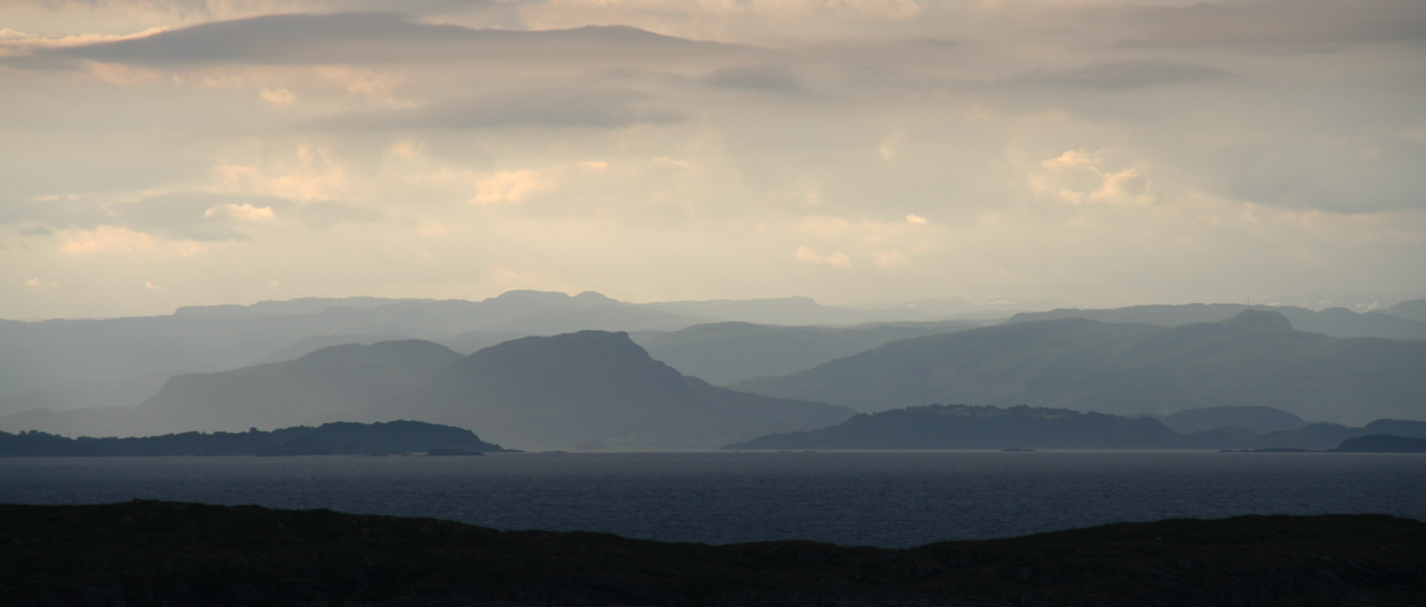
We hadden overwegend mooi weer, gelukkig maar. En het was zeker een lonende tocht, ik zou het zo weer doen!
Hé,
prachtige fotos! goed weer gehad? lonende tocht?
Zo te zien wel. Tot horens
JH en M